Could the earliest weakening of the polar vortex on record bring UK snow?
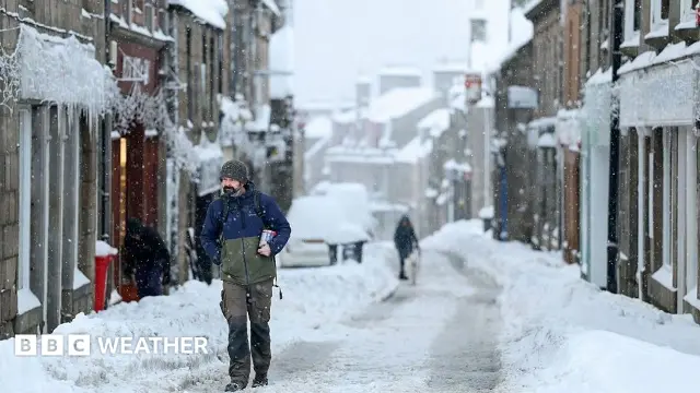
Each winter, strong winds typically swirl around the North Pole high above the Arctic, creating what is known as the polar vortex. This natural phenomenon helps to contain some of the coldest air on the planet. However, in recent days, this well-established circulation has weakened considerably and shifted its usual position. While it is not uncommon for the polar vortex to be disrupted during winter, scientists highlight that an event occurring this early in November is without precedent in modern records. Previous disturbances of the vortex have sometimes been followed by colder weather in parts of Europe and North America, but because this shift is happening so prematurely, there is limited historical data to draw comparisons from, adding uncertainty to current winter weather forecasts.
The polar vortex forms each autumn when temperatures drop rapidly in the Arctic. At an altitude of roughly 10 to 30 miles (15-50 km) above the Earth’s surface, strong westerly winds develop in the stratosphere, confining the coldest air close to the pole. When atmospheric disturbances occur, these high-altitude winds can warm suddenly, causing the vortex to weaken. This phenomenon, known as sudden stratospheric warming (SSW), may lead to the reversal of these winds, changing from westerly to easterly. Such changes often impact the jet stream’s path, which can result in blocked weather patterns bringing colder, drier air from the Arctic into regions such as eastern parts of the UK, increasing the chances of snowfall.
Currently, the polar vortex is displaying an unusually early and dramatic weakening. Some forecasts even suggest that by mid-November, the vortex winds might reverse direction entirely—signifying a major SSW event. According to Jeff Knight, lead climate scientist at the Met Office, “It would appear to be the earliest on record looking back over the 75 years we’ve been observing…with most experts agreeing this is a very unusual event.” Historically, the earliest known major SSW took place on 28 November in 1969 and then again in 2025. The exact reasons for this early disruption remain unclear; it may simply reflect natural variability in weather or be influenced by other climatic factors. For example, a normal El Niño event typically leads to a weakening of the polar vortex toward the end of winter. This connection arises because the warmer Pacific waters influence tropical weather, which then sends pulses of energy known as planetary waves that can disturb polar atmospheric circulation.
Regarding the potential impacts on the UK, long-range Met Office forecasts have suggested a stormy start to winter, followed by colder conditions later, in line with typical El Niño effects. Yet, the early timing of this SSW event was largely unexpected. Professor Andrew Perez-Charlton of the University of Reading noted, “The typical response to a SSW is for colder and drier conditions over Europe and the UK.” However, he added that the unprecedented timing makes predicting a cold spell difficult because the Arctic is not yet as cold as it is in mid-winter and the polar vortex is still in its early stages. This means any weather influence might be weaker than if the disruption occurred deeper into winter, and consequently, snow or severe cold in the near term is not assured. Instead, meteorologists are watching closely, as one concern is the continuation of drier-than-average weather, which could exacerbate existing drought conditions in England and Wales, stressing the importance of replenishing reservoirs during the coming seasons
On air now
Low-Fi Lounge